Garmin Avionics Terrain Elevation Color Gradients
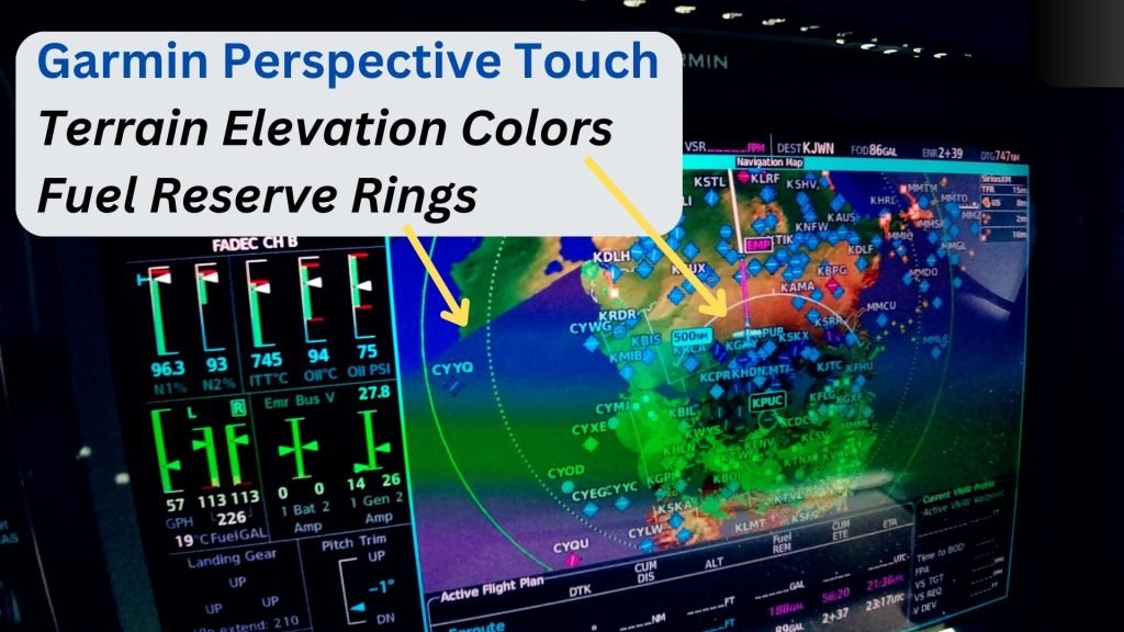
Come along as I show you about the Garmin elevation map colors and fuel reserve ring information for a SF50 Vision Jet.
These elevation color gradients on the map help pilots immediately identify changes in terrain elevations.
Check out the YouTube video below where I talk about these cool features of the Garmin Perspective Touch avionics system.
Let’s Connect
Whether you’re looking for a contract pilot, Supervised Operating Experience – SOE mentor, or long-term operational partner, SF50 Flight Support provides the reliability and expertise your Vision Jet deserves.
📍 Based in the Nashville area — supporting Vision Jet operations nationwide.
📧 Contact us today to discuss your upcoming flight needs. Call or text (615) 543-8553 or schedule a call.
For more video content, check out our – YouTube channel.